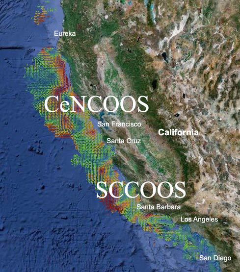


The COCMP project ended in 2010. Surface Current observations in California are currently funded by the Integrated Ocean Observing System and operated by the Central & Northern California Ocean Observing System (CeNCOOS) and the Southern California Coastal Ocean Observing System (SCCOOS).
History: In 2005, the California State Coastal Conservancy and the State Water Resources Control Board invested $21 million from voter-approved Propositions 40 and 50 funds to build the infrastructure to map ocean surface currents. The California Coastal Ocean Currents Monitoring Program (COCMP) uses a suite of technologies, high-frequency radar in particular, to track ocean surface currents in near real-time. The 54 land-based stations now span the California coastline, providing anyone with access to the Internet the ability to track past and near real-time movement of California’s coastal waters, including any floating pollutants. COCMP is an investment by the State of California to better manage our ocean and coastal resources, and to ensure a healthy ocean environment for current and future generations.
SURFACE CURRENT MAP FOR CALIFORNIA: